 vesseltracker.com
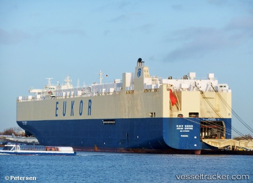
Vessel Asian Empire IMO: 9176606, MMSI: 440114000 Vehicles Carrier
UTC, 57.68944, 11.86668, course: 198, speed: 0
UTC, 57.68941, 11.86672, course: 198, speed: 0
2026-03-01 09:56:19 UTC, 57.68941, 11.86673, course: 198, speed: 0
Live AIS position:
UTC. Near LANGEDRAG),
updated 2026-03-01 09:56:19 UTC.
Find the position of the vessel Asian Empire on the map. The latter are known coordinates and path.
marine traffic ship tracker show on live map
The current position of vessel Asian Empire is 57.68941 lat / 11.86673 lng. Updated: 2026-03-01 09:56:19 UTCDetails:
Last coordinates of the vessel:
UTC, 57.68940, 11.86665, course: 198, speed: 0UTC, 57.68944, 11.86668, course: 198, speed: 0
UTC, 57.68941, 11.86672, course: 198, speed: 0
2026-03-01 09:56:19 UTC, 57.68941, 11.86673, course: 198, speed: 0