 vesseltracker.com
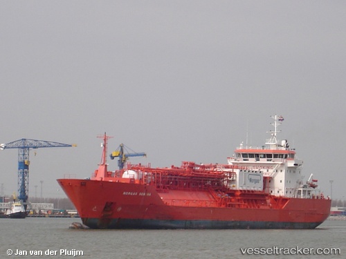
Vessel INWANG IMO: 9240134, MMSI: 440198000 LPG Tanker
UTC, 38.95346, 117.74033, course: 290, speed: 0
UTC, 38.95347, 117.74024, course: 290, speed: 0
2026-01-31 14:11:25 UTC, 38.95346, 117.74034, course: 290, speed: 0
Live AIS position:
UTC. Near Tianjin Pt),
updated 2026-01-31 14:11:25 UTC.
Find the position of the vessel INWANG on the map. The latter are known coordinates and path.
marine traffic ship tracker show on live map
The current position of vessel INWANG is 38.95346 lat / 117.74034 lng. Updated: 2026-01-31 14:11:25 UTCCurrently sailing under the flag of Korea (Republic of)
INWANG built in 2003 year
Deadweight:
9352 tDetails:
Last coordinates of the vessel:
UTC, 38.95347, 117.74025, course: 290, speed: 0UTC, 38.95346, 117.74033, course: 290, speed: 0
UTC, 38.95347, 117.74024, course: 290, speed: 0
2026-01-31 14:11:25 UTC, 38.95346, 117.74034, course: 290, speed: 0