 vesseltracker.com
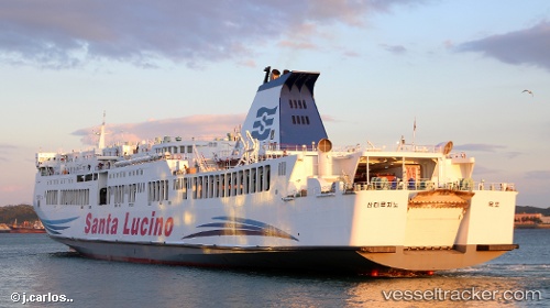
Vessel Santa Lucino IMO: 9117363, MMSI: 440701810 Passenger Ro Ro Cargo Ship
UTC, 36.99620, 126.79497, course: 321, speed: 0
UTC, 36.99620, 126.79497, course: 321, speed: 0
2026-01-18 22:14:57 UTC, 36.99618, 126.79496, course: 322, speed: 0
Live AIS position:
UTC. Near Dangjin),
updated 2026-01-18 22:14:57 UTC.
Find the position of the vessel Santa Lucino on the map. The latter are known coordinates and path.
marine traffic ship tracker show on live map
The current position of vessel Santa Lucino is 36.99618 lat / 126.79496 lng. Updated: 2026-01-18 22:14:57 UTCDetails:
Last coordinates of the vessel:
UTC, 36.99620, 126.79497, course: 321, speed: 0UTC, 36.99620, 126.79497, course: 321, speed: 0
UTC, 36.99620, 126.79497, course: 321, speed: 0
2026-01-18 22:14:57 UTC, 36.99618, 126.79496, course: 322, speed: 0