 vesseltracker.com
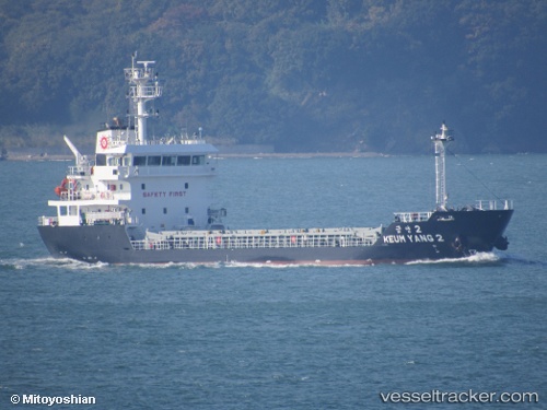
Find the position of the vessel Keum Yang 2 on the map. The latter are known coordinates and path.
marine traffic ship tracker show on live map
The current position of vessel Keum Yang 2 is 34.1968 lat / 132.607 lng. Updated: 2024-05-06 16:45:32 UTCCurrently sailing under the flag of Korea
Port of registry:
Jeju (city in South Korea)Payload_mass:
3602 tonneGross tonnage:
2347Service entry:
2016-01-01T00:00:00ZDetails:
Last coordinates of the vessel:
UTC, 34.1963, 132.606, course: 70, speed: 0.1UTC, 34.1963, 132.606, course: 52, speed: 0.1
UTC, 34.197, 132.607, course: 228, speed: 0
2024-05-06 16:45:32 UTC, 34.1968, 132.607, course: 242, speed: 0.1