 vesseltracker.com
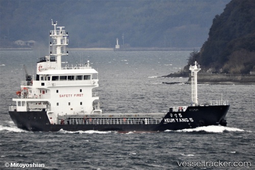
Vessel Keum Yang 5 IMO: 9793337, MMSI: 440760000 General Cargo Ship
UTC, 35.41470, 139.83318, course: 49, speed: 0
UTC, 35.41480, 139.83307, course: 62, speed: 0
2026-01-31 09:43:52 UTC, 35.41469, 139.83333, course: 27, speed: 0
Live AIS position:
UTC. Near KIMITSU),
updated 2026-01-31 09:43:52 UTC.
Find the position of the vessel Keum Yang 5 on the map. The latter are known coordinates and path.
marine traffic ship tracker show on live map
The current position of vessel Keum Yang 5 is 35.41469 lat / 139.83333 lng. Updated: 2026-01-31 09:43:52 UTCDetails:
Last coordinates of the vessel:
UTC, 35.41462, 139.83331, course: 34, speed: 0UTC, 35.41470, 139.83318, course: 49, speed: 0
UTC, 35.41480, 139.83307, course: 62, speed: 0
2026-01-31 09:43:52 UTC, 35.41469, 139.83333, course: 27, speed: 0