 vesseltracker.com
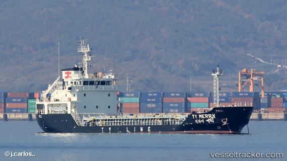
Vessel Ty Merry IMO: 9841330, MMSI: 441415000 General Cargo Ship
UTC, 34.89357, 127.69419, course: 262, speed: 0.1
UTC, 34.89372, 127.69410, course: 254, speed: 0
2026-01-28 13:21:03 UTC, 34.89361, 127.69421, course: 262, speed: 0.1
Live AIS position:
UTC. Near Gwangyang),
updated 2026-01-28 13:21:03 UTC.
Find the position of the vessel Ty Merry on the map. The latter are known coordinates and path.
marine traffic ship tracker show on live map
The current position of vessel Ty Merry is 34.89361 lat / 127.69421 lng. Updated: 2026-01-28 13:21:03 UTCCurrently sailing under the flag of Korea
Details:
Last coordinates of the vessel:
UTC, 34.89317, 127.69412, course: 294, speed: 0.1UTC, 34.89357, 127.69419, course: 262, speed: 0.1
UTC, 34.89372, 127.69410, course: 254, speed: 0
2026-01-28 13:21:03 UTC, 34.89361, 127.69421, course: 262, speed: 0.1