 vesseltracker.com
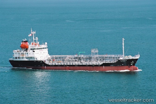
Vessel Nuri Hana IMO: 9397169, MMSI: 441905000 Chemical Oil Products Tanker
UTC, 35.57667, 140.01666, course: -1, speed: 0
UTC, 35.57667, 140.01666, course: -1, speed: 0
2026-03-18 07:27:45 UTC, 35.57667, 140.01500, course: -1, speed: 0
Live Vessel Nuri Hana Analytics (details, animations, etc.)
Live AIS position: UTC. Near CHIBA), updated 2026-03-18 07:27:45 UTC.Find the position of the vessel Nuri Hana on the map. The latter are known coordinates and path.
marine traffic ship tracker show on live map
The current position of vessel Nuri Hana is 35.57667 lat / 140.01500 lng. Updated: 2026-03-18 07:27:45 UTCDetails:
Last coordinates of the vessel:
UTC, 35.57734, 140.01698, course: 254, speed: 0UTC, 35.57667, 140.01666, course: -1, speed: 0
UTC, 35.57667, 140.01666, course: -1, speed: 0
2026-03-18 07:27:45 UTC, 35.57667, 140.01500, course: -1, speed: 0