 vesseltracker.com
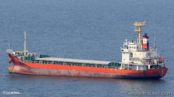
Vessel Kara IMO: 9623398, MMSI: 441956000 General Cargo Ship
UTC, 36.01167, 129.39500, course: -1, speed: 0
UTC, 36.01167, 129.39500, course: -1, speed: 0
2026-01-15 11:11:46 UTC, 36.01183, 129.39545, course: 209, speed: 0
Live AIS position:
UTC. Near Pohang),
updated 2026-01-15 11:11:46 UTC.
Find the position of the vessel Kara on the map. The latter are known coordinates and path.
marine traffic ship tracker show on live map
The current position of vessel Kara is 36.01183 lat / 129.39545 lng. Updated: 2026-01-15 11:11:46 UTCCurrently sailing under the flag of Korea
Details:
Last coordinates of the vessel:
UTC, 36.01167, 129.39500, course: -1, speed: 0UTC, 36.01167, 129.39500, course: -1, speed: 0
UTC, 36.01167, 129.39500, course: -1, speed: 0
2026-01-15 11:11:46 UTC, 36.01183, 129.39545, course: 209, speed: 0