 vesseltracker.com
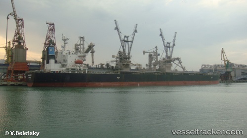
Vessel Malakand IMO: 9304198, MMSI: 463041101 Bulk Carrier
UTC, 22.77250, 113.63931, course: 327, speed: 0
UTC, 22.77249, 113.64058, course: 310, speed: 0.4
2026-02-12 17:50:42 UTC, 22.77161, 113.63980, course: 344, speed: 0.3
Live AIS position:
UTC. Near Nansha Pt),
updated 2026-02-12 17:50:42 UTC.
Find the position of the vessel Malakand on the map. The latter are known coordinates and path.
marine traffic ship tracker show on live map
The current position of vessel Malakand is 22.77161 lat / 113.63980 lng. Updated: 2026-02-12 17:50:42 UTCDetails:
Last coordinates of the vessel:
UTC, 22.77351, 113.63988, course: 307, speed: 0UTC, 22.77250, 113.63931, course: 327, speed: 0
UTC, 22.77249, 113.64058, course: 310, speed: 0.4
2026-02-12 17:50:42 UTC, 22.77161, 113.63980, course: 344, speed: 0.3