 vesseltracker.com
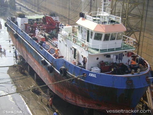
Vessel Amal IMO: 9239953, MMSI: 470810000 Oil Products Tanker
UTC, 25.18971, 56.51287, course: -1, speed: 1.6
UTC, 25.18618, 56.51317, course: -1, speed: 0.1
2026-02-07 17:47:11 UTC, 25.18649, 56.51358, course: -1, speed: 0.1
Live AIS position:
UTC. Near Fujairah),
updated 2026-02-07 17:47:11 UTC.
Find the position of the vessel Amal on the map. The latter are known coordinates and path.
marine traffic ship tracker show on live map
The current position of vessel Amal is 25.18649 lat / 56.51358 lng. Updated: 2026-02-07 17:47:11 UTCDetails:
Last coordinates of the vessel:
UTC, 25.14943, 56.52263, course: -1, speed: 3.1UTC, 25.18971, 56.51287, course: -1, speed: 1.6
UTC, 25.18618, 56.51317, course: -1, speed: 0.1
2026-02-07 17:47:11 UTC, 25.18649, 56.51358, course: -1, speed: 0.1