 vesseltracker.com
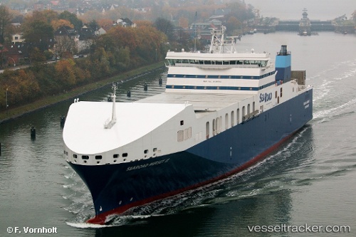
Vessel Searoad Mersey 2 IMO: 9745794, MMSI: 503000108 Container Ro Ro Cargo Ship
UTC, -39.80378, 145.50887, course: 157, speed: 19
UTC, -40.52711, 145.97847, course: 156, speed: 19
2026-03-05 18:01:39 UTC, -41.07007, 146.33105, course: 154, speed: 20.2
Live Vessel Searoad Mersey 2 Analytics (details, animations, etc.)
Live AIS position: UTC. Near East Devonport), updated 2026-03-05 18:01:39 UTC.Find the position of the vessel Searoad Mersey 2 on the map. The latter are known coordinates and path.
marine traffic ship tracker show on live map
The current position of vessel Searoad Mersey 2 is -41.07007 lat / 146.33105 lng. Updated: 2026-03-05 18:01:39 UTCCurrently sailing under the flag of Australia
Details:
Last coordinates of the vessel:
UTC, -39.49233, 145.28506, course: 150, speed: 19.1UTC, -39.80378, 145.50887, course: 157, speed: 19
UTC, -40.52711, 145.97847, course: 156, speed: 19
2026-03-05 18:01:39 UTC, -41.07007, 146.33105, course: 154, speed: 20.2