 vesseltracker.com
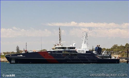
Vessel Border Force Cutter IMO: 9684586, MMSI: 503007250 Patrol Vessel
UTC, -12.48758, 130.87706, course: 127, speed: 0
UTC, -12.48758, 130.87704, course: 127, speed: 0
2026-01-29 00:24:24 UTC, -12.48758, 130.87704, course: 127, speed: 0
Live AIS position:
UTC. Near East Arm),
updated 2026-01-29 00:24:24 UTC.
Find the position of the vessel Border Force Cutter on the map. The latter are known coordinates and path.
marine traffic ship tracker show on live map
The current position of vessel Border Force Cutter is -12.48758 lat / 130.87704 lng. Updated: 2026-01-29 00:24:24 UTCDetails:
Last coordinates of the vessel:
UTC, -12.48758, 130.87706, course: 126, speed: 0UTC, -12.48758, 130.87706, course: 127, speed: 0
UTC, -12.48758, 130.87704, course: 127, speed: 0
2026-01-29 00:24:24 UTC, -12.48758, 130.87704, course: 127, speed: 0