 vesseltracker.com
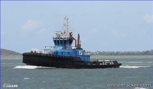
Sl Curtis Island
Current StatusWhere is the vessel?
Sl Curtis Island is currently in Near GLADSTONE, based on AIS data received about 3h ago.
Latest AIS update:
Current position: 23.82333° S, 151.24333° E (Near GLADSTONE)
Average speed (last 7 days): Loading…
Average speed (last 30 days): Loading…
Vessel profile: Sl Curtis Island is a [tug.fire_fighting_tug] with dimensions 15m x 34m.
This page combines live AIS, route history, probable destination signals, nearby traffic, and port activity for practical vessel monitoring.
The current position of vessel Sl Curtis Island is -23.82333 lat / 151.24333 lng. Updated: 2026-03-25 15:36:00 UTCNearest reference points:
- Near Gladstone Harbor
- Near Boyne Island
- Near ROSSLYN
Details:
Live Vessel Sl Curtis Island Analytics (details, animations, etc.)
Recent AIS points (UTC):
2026-03-25 09:44:12 UTC · -23.82107, 151.25238 · SOG 8.3 kn · COG 130°2026-03-25 12:10:17 UTC · -23.82482, 151.24426 · SOG 0 kn · COG 258°
2026-03-25 14:22:13 UTC · -23.82482, 151.24426 · SOG 0 kn · COG 257°
2026-03-25 15:36:00 UTC · -23.82333, 151.24333 · SOG 0 kn · COG -1°