 vesseltracker.com
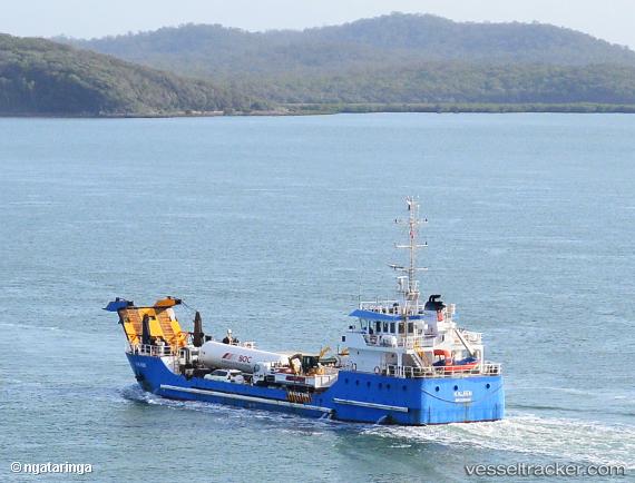
Vessel Kaleen IMO: 9640047, MMSI: 503720000 Landing Craft
UTC, -23.82861, 151.24194, course: 309, speed: 0
UTC, -23.82862, 151.24193, course: 310, speed: 0
2026-01-19 13:35:41 UTC, -23.82859, 151.24191, course: 309, speed: 0
Live AIS position:
UTC. Near Gladstone Harbor),
updated 2026-01-19 13:35:41 UTC.
Find the position of the vessel Kaleen on the map. The latter are known coordinates and path.
marine traffic ship tracker show on live map
The current position of vessel Kaleen is -23.82859 lat / 151.24191 lng. Updated: 2026-01-19 13:35:41 UTCCurrently sailing under the flag of Australia
Kaleen built in 2012 year
Deadweight:
1500 tDetails:
Last coordinates of the vessel:
UTC, -23.82861, 151.24193, course: 310, speed: 0UTC, -23.82861, 151.24194, course: 309, speed: 0
UTC, -23.82862, 151.24193, course: 310, speed: 0
2026-01-19 13:35:41 UTC, -23.82859, 151.24191, course: 309, speed: 0