 vesseltracker.com
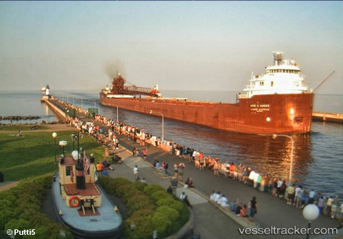
Find the position of the vessel Kaye E Barker on the map. The latter are known coordinates and path.
marine traffic ship tracker show on live map
The current position of vessel Kaye E Barker is 43.8857 lat / -82.4814 lng. Updated: 2024-04-29 03:59:03 UTCCurrently sailing under the flag of USA
Kaye E Barker built in 1952 year
Port of registry:
Cleveland (city in and county seat of Cuyahoga County, Ohio, United States)Deadweight:
25345 tGross tonnage:
11948Service entry:
1952-01-01T00:00:00ZDetails:
Last coordinates of the vessel:
UTC, 44.6143, -82.8038, course: 163, speed: 13UTC, 44.4483, -82.7267, course: -1, speed: 12
UTC, 44.2676, -82.6488, course: 163, speed: 13
2024-04-29 03:59:03 UTC, 43.8857, -82.4814, course: 175, speed: 13