 vesseltracker.com
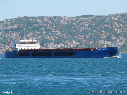
Find the position of the vessel CHELSEA 4 on the map. The latter are known coordinates and path.
marine traffic ship tracker show on live map
The current position of vessel CHELSEA 4 is 41.3435 lat / 36.3433 lng. Updated: 2024-04-30 00:21:13 UTCCurrently sailing under the flag of Palau (Republic of)
CHELSEA 4 built in 2007 year
Port of registry:
Valletta (capital of Malta)Deadweight:
6000 tPayload_mass:
6000 tonneGross tonnage:
5184Service entry:
2007-01-01T00:00:00ZDetails:
Last coordinates of the vessel:
UTC, 41.3432, 36.3425, course: 346, speed: 0UTC, 41.3432, 36.3426, course: 343, speed: 0
UTC, 41.3433, 36.343, course: 334, speed: 0
2024-04-30 00:21:13 UTC, 41.3435, 36.3433, course: 314, speed: 0