 vesseltracker.com
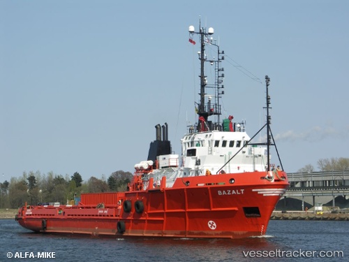
Vessel BAZALT IMO: 7911636, MMSI: 511101010 Offshore Supply Ship
UTC, 19.49613, 37.32394, course: -1, speed: 0.1
UTC, 19.34024, 36.60680, course: -1, speed: 38.9
2026-03-24 16:54:35 UTC, 19.34024, 36.60680, course: -1, speed: 38.9
Live Vessel BAZALT Analytics (details, animations, etc.)
Live AIS position: UTC. 39 nm SW of Port Sudan), updated 2026-03-24 16:54:35 UTC.Find the position of the vessel BAZALT on the map. The latter are known coordinates and path.
marine traffic ship tracker show on live map
The current position of vessel BAZALT is 19.34024 lat / 36.60680 lng. Updated: 2026-03-24 16:54:35 UTCCurrently sailing under the flag of Palau
Details:
Last coordinates of the vessel:
UTC, 19.49600, 37.32381, course: -1, speed: 0.1UTC, 19.49613, 37.32394, course: -1, speed: 0.1
UTC, 19.34024, 36.60680, course: -1, speed: 38.9
2026-03-24 16:54:35 UTC, 19.34024, 36.60680, course: -1, speed: 38.9