 vesseltracker.com
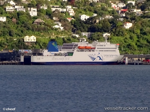
Vessel Kaitaki IMO: 9107942, MMSI: 512445000 Passenger Ro Ro Cargo Ship
UTC, -41.40500, 174.76167, course: -1, speed: 11
UTC, -41.27212, 174.41827, course: 307, speed: 16.5
2026-03-02 14:16:39 UTC, -41.28387, 174.00665, course: 42, speed: 0
Live AIS position:
UTC. Near WAIKAWA),
updated 2026-03-02 14:16:39 UTC.
Find the position of the vessel Kaitaki on the map. The latter are known coordinates and path.
marine traffic ship tracker show on live map
The current position of vessel Kaitaki is -41.28387 lat / 174.00665 lng. Updated: 2026-03-02 14:16:39 UTCCurrently sailing under the flag of New Zealand
Kaitaki built in 1995 year
Deadweight:
5794 tDetails:
Last coordinates of the vessel:
UTC, -41.26500, 174.78833, course: -1, speed: 0UTC, -41.40500, 174.76167, course: -1, speed: 11
UTC, -41.27212, 174.41827, course: 307, speed: 16.5
2026-03-02 14:16:39 UTC, -41.28387, 174.00665, course: 42, speed: 0