 vesseltracker.com
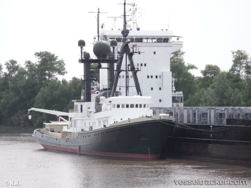
Vessel SEA RANGER IMO: 1004900, MMSI: 518999879 Yacht
UTC, 40.83700, 29.27924, course: 305, speed: 0
UTC, 40.83702, 29.27924, course: 305, speed: 0
2026-02-23 21:35:16 UTC, 40.83702, 29.27923, course: 305, speed: 0
Live AIS position:
UTC. Near TUZLA),
updated 2026-02-23 21:35:16 UTC.
Find the position of the vessel SEA RANGER on the map. The latter are known coordinates and path.
marine traffic ship tracker show on live map
The current position of vessel SEA RANGER is 40.83702 lat / 29.27923 lng. Updated: 2026-02-23 21:35:16 UTCCurrently sailing under the flag of Cook Islands
Details:
Last coordinates of the vessel:
UTC, 40.83703, 29.27923, course: 305, speed: 0UTC, 40.83700, 29.27924, course: 305, speed: 0
UTC, 40.83702, 29.27924, course: 305, speed: 0
2026-02-23 21:35:16 UTC, 40.83702, 29.27923, course: 305, speed: 0