 vesseltracker.com
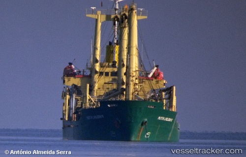
Vessel MUTIA LADJONI 9 IMO: 9016167, MMSI: 525003305 General Cargo Ship
UTC, -7.08387, 112.66475, course: -1, speed: 0.3
UTC, -7.08446, 112.66442, course: -1, speed: 0.2
2026-01-28 07:21:44 UTC, -7.08460, 112.66430, course: -1, speed: 0.1
Live AIS position:
UTC. Near GRESIK),
updated 2026-01-28 07:21:44 UTC.
Find the position of the vessel MUTIA LADJONI 9 on the map. The latter are known coordinates and path.
marine traffic ship tracker show on live map
The current position of vessel MUTIA LADJONI 9 is -7.08460 lat / 112.66430 lng. Updated: 2026-01-28 07:21:44 UTCCurrently sailing under the flag of Indonesia
MUTIA LADJONI 9 built in 1991 year
Deadweight:
7194 tDetails:
Last coordinates of the vessel:
UTC, -7.08287, 112.66461, course: -1, speed: 0.1UTC, -7.08387, 112.66475, course: -1, speed: 0.3
UTC, -7.08446, 112.66442, course: -1, speed: 0.2
2026-01-28 07:21:44 UTC, -7.08460, 112.66430, course: -1, speed: 0.1