 vesseltracker.com
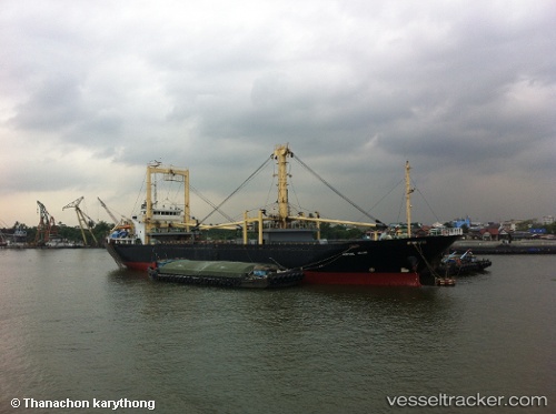
Vessel Fortune Island IMO: 9140396, MMSI: 525005398 General Cargo Ship
UTC, -6.09500, 106.94833, course: -1, speed: 0
UTC, -6.03310, 106.95512, course: 45, speed: 0.5
2026-01-28 02:17:36 UTC, -6.03383, 106.95635, course: 303, speed: 0.2
Live AIS position:
UTC. Near Cilincing),
updated 2026-01-28 02:17:36 UTC.
Find the position of the vessel Fortune Island on the map. The latter are known coordinates and path.
marine traffic ship tracker show on live map
The current position of vessel Fortune Island is -6.03383 lat / 106.95635 lng. Updated: 2026-01-28 02:17:36 UTCDetails:
Last coordinates of the vessel:
UTC, -6.09500, 106.94833, course: -1, speed: 0UTC, -6.09500, 106.94833, course: -1, speed: 0
UTC, -6.03310, 106.95512, course: 45, speed: 0.5
2026-01-28 02:17:36 UTC, -6.03383, 106.95635, course: 303, speed: 0.2