 vesseltracker.com
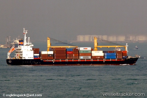
Vessel Tanto Terang IMO: 9169653, MMSI: 525013021 Container Ship
UTC, -6.10101, 106.88382, course: -1, speed: 0
UTC, -6.10100, 106.88382, course: -1, speed: 0
2026-03-15 20:07:26 UTC, -6.10099, 106.88385, course: -1, speed: 0
Live Vessel Tanto Terang Analytics (details, animations, etc.)
Live AIS position: UTC. Near Jakarta), updated 2026-03-15 20:07:26 UTC.Find the position of the vessel Tanto Terang on the map. The latter are known coordinates and path.
marine traffic ship tracker show on live map
The current position of vessel Tanto Terang is -6.10099 lat / 106.88385 lng. Updated: 2026-03-15 20:07:26 UTCCurrently sailing under the flag of Indonesia
Tanto Terang built in 1998 year
Deadweight:
12250 tDetails:
Last coordinates of the vessel:
UTC, -6.10104, 106.88384, course: -1, speed: 0UTC, -6.10101, 106.88382, course: -1, speed: 0
UTC, -6.10100, 106.88382, course: -1, speed: 0
2026-03-15 20:07:26 UTC, -6.10099, 106.88385, course: -1, speed: 0