 vesseltracker.com
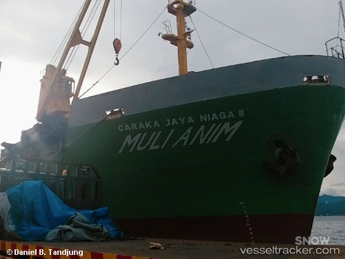
Vessel Mv.mulianim IMO: 9310501, MMSI: 525015026 Container Ship
UTC, -7.18163, 112.69764, course: -1, speed: 0.2
UTC, -7.18165, 112.69778, course: -1, speed: 0.3
2026-01-28 07:23:36 UTC, -7.18203, 112.69766, course: -1, speed: 0.3
Live AIS position:
UTC. Near Kalianak Barat),
updated 2026-01-28 07:23:36 UTC.
Find the position of the vessel Mv.mulianim on the map. The latter are known coordinates and path.
marine traffic ship tracker show on live map
The current position of vessel Mv.mulianim is -7.18203 lat / 112.69766 lng. Updated: 2026-01-28 07:23:36 UTCDetails:
Last coordinates of the vessel:
UTC, -7.18077, 112.69617, course: -1, speed: 0UTC, -7.18163, 112.69764, course: -1, speed: 0.2
UTC, -7.18165, 112.69778, course: -1, speed: 0.3
2026-01-28 07:23:36 UTC, -7.18203, 112.69766, course: -1, speed: 0.3