 vesseltracker.com
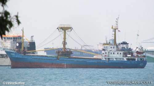
Vessel Berjaya 2 IMO: 9073907, MMSI: 525015292 General Cargo Ship
UTC, 1.00576, 103.95837, course: -1, speed: 0
UTC, 1.00576, 103.95837, course: -1, speed: 0
2026-02-18 01:13:03 UTC, 1.00576, 103.95837, course: -1, speed: 0
Live AIS position:
UTC. Near Batam Island),
updated 2026-02-18 01:13:03 UTC.
Find the position of the vessel Berjaya 2 on the map. The latter are known coordinates and path.
marine traffic ship tracker show on live map
The current position of vessel Berjaya 2 is 1.00576 lat / 103.95837 lng. Updated: 2026-02-18 01:13:03 UTCCurrently sailing under the flag of Indonesia
Berjaya 2 built in 1992 year
Deadweight:
1500 tDetails:
Last coordinates of the vessel:
UTC, 1.00577, 103.95838, course: -1, speed: 0UTC, 1.00576, 103.95837, course: -1, speed: 0
UTC, 1.00576, 103.95837, course: -1, speed: 0
2026-02-18 01:13:03 UTC, 1.00576, 103.95837, course: -1, speed: 0