 vesseltracker.com
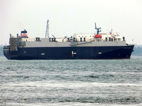
Vessel Kalimantan Leader IMO: 9078567, MMSI: 525015993 Vehicles Carrier
UTC, -5.65621, 113.76646, course: -1, speed: 8.4
UTC, -5.65621, 113.76646, course: -1, speed: 8.4
2026-01-29 17:27:41 UTC, -5.65621, 113.76646, course: -1, speed: 8.4
Live AIS position:
UTC. 60 nm NE of Camar Marine Terminal),
updated 2026-01-29 17:27:41 UTC.
Find the position of the vessel Kalimantan Leader on the map. The latter are known coordinates and path.
marine traffic ship tracker show on live map
The current position of vessel Kalimantan Leader is -5.65621 lat / 113.76646 lng. Updated: 2026-01-29 17:27:41 UTCCurrently sailing under the flag of Indonesia
Kalimantan Leader built in 1994 year
Deadweight:
4051 tDetails:
Last coordinates of the vessel:
UTC, -5.71830, 107.44185, course: -1, speed: 9.5UTC, -5.65621, 113.76646, course: -1, speed: 8.4
UTC, -5.65621, 113.76646, course: -1, speed: 8.4
2026-01-29 17:27:41 UTC, -5.65621, 113.76646, course: -1, speed: 8.4