 vesseltracker.com
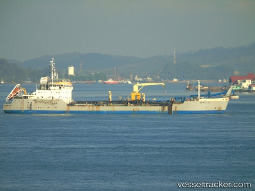
Vessel BALI II IMO: 9061461, MMSI: 525019686 Hopper Dredger
UTC, -6.11167, 106.86167, course: -1, speed: 0
UTC, -6.11167, 106.86167, course: -1, speed: 0
2026-02-20 15:36:57 UTC, -6.11167, 106.86167, course: -1, speed: 0
Live AIS position:
UTC. Near Ancol),
updated 2026-02-20 15:36:57 UTC.
Find the position of the vessel BALI II on the map. The latter are known coordinates and path.
marine traffic ship tracker show on live map
The current position of vessel BALI II is -6.11167 lat / 106.86167 lng. Updated: 2026-02-20 15:36:57 UTCCurrently sailing under the flag of Indonesia
BALI II built in 1993 year
Deadweight:
10507 tDetails:
Last coordinates of the vessel:
UTC, -6.11268, 106.86201, course: -1, speed: 0UTC, -6.11167, 106.86167, course: -1, speed: 0
UTC, -6.11167, 106.86167, course: -1, speed: 0
2026-02-20 15:36:57 UTC, -6.11167, 106.86167, course: -1, speed: 0