 vesseltracker.com
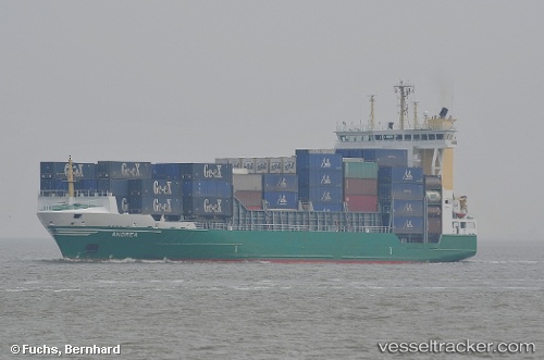
Vessel Meratus Mamiri IMO: 9106649, MMSI: 525025076 Container Ship
UTC, -6.04994, 106.89446, course: 77, speed: 0.1
UTC, -6.04924, 106.89477, course: 122, speed: 0.1
2026-01-30 06:17:24 UTC, -6.04873, 106.89639, course: 211, speed: 0
Live AIS position:
UTC. Near New Priok Port),
updated 2026-01-30 06:17:24 UTC.
Find the position of the vessel Meratus Mamiri on the map. The latter are known coordinates and path.
marine traffic ship tracker show on live map
The current position of vessel Meratus Mamiri is -6.04873 lat / 106.89639 lng. Updated: 2026-01-30 06:17:24 UTCDetails:
Last coordinates of the vessel:
UTC, -6.04921, 106.89466, course: 108, speed: 0.1UTC, -6.04994, 106.89446, course: 77, speed: 0.1
UTC, -6.04924, 106.89477, course: 122, speed: 0.1
2026-01-30 06:17:24 UTC, -6.04873, 106.89639, course: 211, speed: 0