 vesseltracker.com
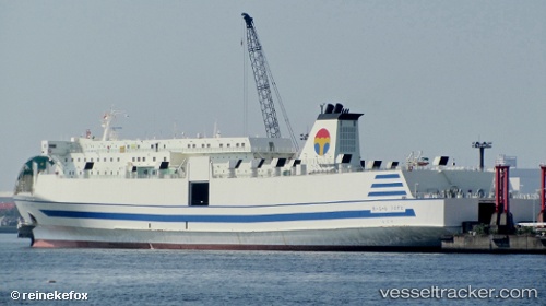
Find the position of the vessel Mutiara Barat on the map. The latter are known coordinates and path.
marine traffic ship tracker show on live map
The current position of vessel Mutiara Barat is -8.7009833333333 lat / 116.04641666667 lng. Updated: 2025-09-22 19:19:50 UTCCurrently sailing under the flag of Indonesia
Mutiara Barat built in 1991 year
Deadweight:
3500 tDetails:
Last coordinates of the vessel:
UTC, -8.7009833333333, 116.04641666667, course: -1, speed: 0.1UTC, -8.7009833333333, 116.04641666667, course: -1, speed: 0.1
UTC, -8.7009833333333, 116.04641666667, course: -1, speed: 0.1
2025-09-22 19:19:50 UTC, -8.7009833333333, 116.04641666667, course: -1, speed: 0.1