 vesseltracker.com
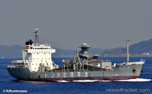
Vessel Sensho IMO: 8608365, MMSI: 525119006 Cement Carrier
UTC, 16.93833, 54.00667, course: -1, speed: 0
UTC, 16.93977, 54.00717, course: 297, speed: 0
2026-01-30 06:28:01 UTC, 16.93985, 54.00716, course: 297, speed: 0.1
Live AIS position:
UTC. Near Port Raysut),
updated 2026-01-30 06:28:01 UTC.
Find the position of the vessel Sensho on the map. The latter are known coordinates and path.
marine traffic ship tracker show on live map
The current position of vessel Sensho is 16.93985 lat / 54.00716 lng. Updated: 2026-01-30 06:28:01 UTCCurrently sailing under the flag of Indonesia
Details:
Last coordinates of the vessel:
UTC, 16.93977, 54.00715, course: 298, speed: 0UTC, 16.93833, 54.00667, course: -1, speed: 0
UTC, 16.93977, 54.00717, course: 297, speed: 0
2026-01-30 06:28:01 UTC, 16.93985, 54.00716, course: 297, speed: 0.1