 vesseltracker.com
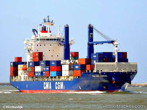
Vessel CMA CGM HOMERE IMO: 9362322, MMSI: 525119170 Container Ship
UTC, 40.64066, -74.19021, course: 224, speed: 0
UTC, 40.64067, -74.19021, course: 223, speed: 0
2026-02-26 09:25:54 UTC, 40.64066, -74.19021, course: 223, speed: 0
Live AIS position:
UTC. Near Elizabethport),
updated 2026-02-26 09:25:54 UTC.
Find the position of the vessel CMA CGM HOMERE on the map. The latter are known coordinates and path.
marine traffic ship tracker show on live map
The current position of vessel CMA CGM HOMERE is 40.64066 lat / -74.19021 lng. Updated: 2026-02-26 09:25:54 UTCCurrently sailing under the flag of Indonesia
CMA CGM HOMERE built in 2007 year
Deadweight:
21264 tDetails:
Last coordinates of the vessel:
UTC, 40.64067, -74.19022, course: 224, speed: 0UTC, 40.64066, -74.19021, course: 224, speed: 0
UTC, 40.64067, -74.19021, course: 223, speed: 0
2026-02-26 09:25:54 UTC, 40.64066, -74.19021, course: 223, speed: 0