 vesseltracker.com
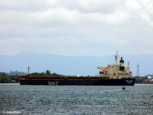
Vessel RUBY INDAH IMO: 9172416, MMSI: 525121059 Bulk Carrier
UTC, -5.99486, 105.93619, course: 246, speed: 0
UTC, -5.99589, 105.93628, course: -1, speed: 0
2026-02-24 23:28:58 UTC, -5.99753, 105.93186, course: 13, speed: 0.1
Live AIS position:
UTC. Near Cigading),
updated 2026-02-24 23:28:58 UTC.
Find the position of the vessel RUBY INDAH on the map. The latter are known coordinates and path.
marine traffic ship tracker show on live map
The current position of vessel RUBY INDAH is -5.99753 lat / 105.93186 lng. Updated: 2026-02-24 23:28:58 UTCCurrently sailing under the flag of Indonesia
Details:
Last coordinates of the vessel:
UTC, -5.99394, 105.93565, course: 225, speed: 0UTC, -5.99486, 105.93619, course: 246, speed: 0
UTC, -5.99589, 105.93628, course: -1, speed: 0
2026-02-24 23:28:58 UTC, -5.99753, 105.93186, course: 13, speed: 0.1