 vesseltracker.com
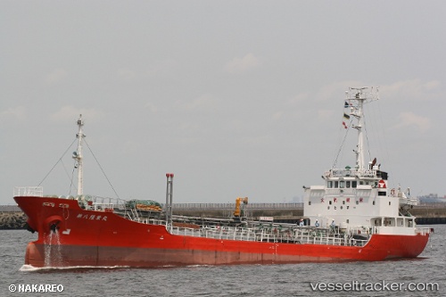
Vessel Rahmat IMO: 9078921, MMSI: 533005700 Oil Products Tanker
UTC, 4.24946, 100.64069, course: -1, speed: 0
UTC, 4.24946, 100.64069, course: -1, speed: 0
2026-01-15 01:46:56 UTC, 4.24946, 100.64069, course: -1, speed: 0
Live AIS position:
UTC. Near Simpang Lima),
updated 2026-01-15 01:46:56 UTC.
Find the position of the vessel Rahmat on the map. The latter are known coordinates and path.
marine traffic ship tracker show on live map
The current position of vessel Rahmat is 4.24946 lat / 100.64069 lng. Updated: 2026-01-15 01:46:56 UTCDetails:
Last coordinates of the vessel:
UTC, 4.24946, 100.64069, course: -1, speed: 0UTC, 4.24946, 100.64069, course: -1, speed: 0
UTC, 4.24946, 100.64069, course: -1, speed: 0
2026-01-15 01:46:56 UTC, 4.24946, 100.64069, course: -1, speed: 0