 vesseltracker.com
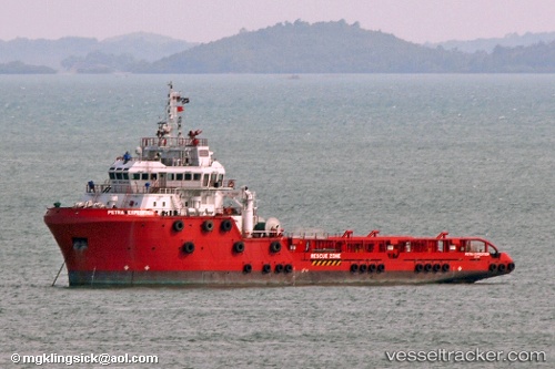
Vessel Perdanaexpedition IMO: 9534119, MMSI: 533059400 Offshore Tug Supply Ship
UTC, 4.24167, 103.50333, course: -1, speed: 0
UTC, 4.24167, 103.50333, course: -1, speed: 0
2026-03-09 21:45:11 UTC, 4.24246, 103.50387, course: -1, speed: 0.4
Live Vessel Perdanaexpedition Analytics (details, animations, etc.)
Live AIS position: UTC. Near KEMAMAN), updated 2026-03-09 21:45:11 UTC.Find the position of the vessel Perdanaexpedition on the map. The latter are known coordinates and path.
marine traffic ship tracker show on live map
The current position of vessel Perdanaexpedition is 4.24246 lat / 103.50387 lng. Updated: 2026-03-09 21:45:11 UTCDetails:
Last coordinates of the vessel:
UTC, 4.24167, 103.50333, course: -1, speed: 0UTC, 4.24167, 103.50333, course: -1, speed: 0
UTC, 4.24167, 103.50333, course: -1, speed: 0
2026-03-09 21:45:11 UTC, 4.24246, 103.50387, course: -1, speed: 0.4