 vesseltracker.com
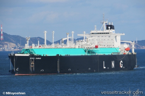
Vessel Puteri Zamrud IMO: 9030838, MMSI: 533130000 Lng Tanker
UTC, 10.07809, 117.75957, course: 67, speed: 13
UTC, 10.32219, 118.01407, course: 42, speed: 13
2026-03-03 14:20:00 UTC, 10.55769, 118.18302, course: 19, speed: 14
Live AIS position:
UTC. 52 nm SW of Tindalo Oil Field),
updated 2026-03-03 14:20:00 UTC.
Find the position of the vessel Puteri Zamrud on the map. The latter are known coordinates and path.
marine traffic ship tracker show on live map
The current position of vessel Puteri Zamrud is 10.55769 lat / 118.18302 lng. Updated: 2026-03-03 14:20:00 UTCDetails:
Last coordinates of the vessel:
UTC, 9.14221, 117.00592, course: 43, speed: 14UTC, 10.07809, 117.75957, course: 67, speed: 13
UTC, 10.32219, 118.01407, course: 42, speed: 13
2026-03-03 14:20:00 UTC, 10.55769, 118.18302, course: 19, speed: 14