 vesseltracker.com
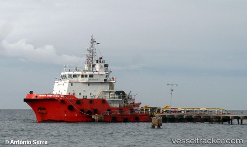
Vessel Bridgewater 131 IMO: 9555412, MMSI: 533131029 Offshore Tug Supply Ship
UTC, 12.26500, 100.80333, course: -1, speed: 7
UTC, 12.06167, 100.74500, course: -1, speed: 6
2026-03-14 18:21:01 UTC, 11.82310, 100.67271, course: 197, speed: 6.5
Live Vessel Bridgewater 131 Analytics (details, animations, etc.)
Live AIS position: UTC. 51 nm S of SATTAHIP), updated 2026-03-14 18:21:01 UTC.Find the position of the vessel Bridgewater 131 on the map. The latter are known coordinates and path.
marine traffic ship tracker show on live map
The current position of vessel Bridgewater 131 is 11.82310 lat / 100.67271 lng. Updated: 2026-03-14 18:21:01 UTCDetails:
Last coordinates of the vessel:
UTC, 12.48752, 100.87544, course: 197, speed: 7.2UTC, 12.26500, 100.80333, course: -1, speed: 7
UTC, 12.06167, 100.74500, course: -1, speed: 6
2026-03-14 18:21:01 UTC, 11.82310, 100.67271, course: 197, speed: 6.5