 vesseltracker.com
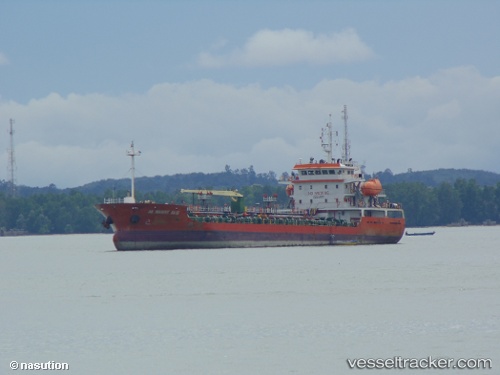
Vessel STRAITS GEMILANG IMO: 9717553, MMSI: 533132112 Oil Products Tanker
UTC, 3.05981, 101.35126, course: -1, speed: 0
UTC, 2.98085, 101.31777, course: 235, speed: 7.6
2026-03-25 04:04:15 UTC, 2.80407, 101.31884, course: 109, speed: 3.9
Live Vessel STRAITS GEMILANG Analytics (details, animations, etc.)
Live AIS position: UTC. Near Pulau Indah), updated 2026-03-25 04:04:15 UTC.Find the position of the vessel STRAITS GEMILANG on the map. The latter are known coordinates and path.
marine traffic ship tracker show on live map
The current position of vessel STRAITS GEMILANG is 2.80407 lat / 101.31884 lng. Updated: 2026-03-25 04:04:15 UTCNearest reference points:
- Near Pulau Indah
- Near Carey Island Estate
- Near Banting
Currently sailing under the flag of Malaysia
STRAITS GEMILANG built in 2013 year
Deadweight:
3714 tDetails:
Last coordinates of the vessel:
UTC, 3.06100, 101.35163, course: -1, speed: 0UTC, 3.05981, 101.35126, course: -1, speed: 0
UTC, 2.98085, 101.31777, course: 235, speed: 7.6
2026-03-25 04:04:15 UTC, 2.80407, 101.31884, course: 109, speed: 3.9