 vesseltracker.com
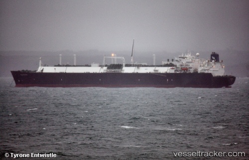
Vessel Golar Maria IMO: 9320374, MMSI: 538002609 Lng Tanker
UTC, 18.42981, -66.10434, course: 238, speed: 0
UTC, 18.42981, -66.10435, course: 239, speed: 0
2026-03-24 07:28:56 UTC, 18.42980, -66.10433, course: -1, speed: 0
Live Vessel Golar Maria Analytics (details, animations, etc.)
Live AIS position: UTC. Near Puerta de Tierra), updated 2026-03-24 07:28:56 UTC.Find the position of the vessel Golar Maria on the map. The latter are known coordinates and path.
marine traffic ship tracker show on live map
The current position of vessel Golar Maria is 18.42980 lat / -66.10433 lng. Updated: 2026-03-24 07:28:56 UTCDetails:
Last coordinates of the vessel:
UTC, 18.42983, -66.10435, course: -1, speed: 0UTC, 18.42981, -66.10434, course: 238, speed: 0
UTC, 18.42981, -66.10435, course: 239, speed: 0
2026-03-24 07:28:56 UTC, 18.42980, -66.10433, course: -1, speed: 0