 vesseltracker.com
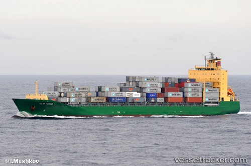
Vessel Cape Ferrol IMO: 9359325, MMSI: 538003221 Container Ship
UTC, 50.90481, -1.45293, course: 305, speed: 0
UTC, 50.90481, -1.45291, course: 305, speed: 0
2026-03-11 14:19:42 UTC, 50.90482, -1.45291, course: 305, speed: 0
Live Vessel Cape Ferrol Analytics (details, animations, etc.)
Live AIS position: UTC. Near Eling), updated 2026-03-11 14:19:42 UTC.Find the position of the vessel Cape Ferrol on the map. The latter are known coordinates and path.
marine traffic ship tracker show on live map
The current position of vessel Cape Ferrol is 50.90482 lat / -1.45291 lng. Updated: 2026-03-11 14:19:42 UTCCurrently sailing under the flag of Marshall Is
Cape Ferrol built in 2008 year
Deadweight:
20346 tDetails:
Last coordinates of the vessel:
UTC, 50.90480, -1.45292, course: 305, speed: 0UTC, 50.90481, -1.45293, course: 305, speed: 0
UTC, 50.90481, -1.45291, course: 305, speed: 0
2026-03-11 14:19:42 UTC, 50.90482, -1.45291, course: 305, speed: 0