 vesseltracker.com
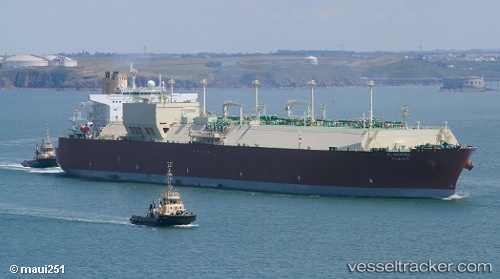
Vessel Al Mayeda IMO: 9397298, MMSI: 538003356 Lng Tanker
UTC, 38.13618, 122.51549, course: 106, speed: 12.4
UTC, 38.11825, 122.67300, course: 102, speed: 12.4
2026-01-13 17:51:25 UTC, 37.89500, 123.29833, course: -1, speed: 12
Live AIS position:
UTC. 42 nm NE of Longyan Pt),
updated 2026-01-13 17:51:25 UTC.
Find the position of the vessel Al Mayeda on the map. The latter are known coordinates and path.
marine traffic ship tracker show on live map
The current position of vessel Al Mayeda is 37.89500 lat / 123.29833 lng. Updated: 2026-01-13 17:51:25 UTCDetails:
Last coordinates of the vessel:
UTC, 38.20158, 122.24129, course: 107, speed: 12.3UTC, 38.13618, 122.51549, course: 106, speed: 12.4
UTC, 38.11825, 122.67300, course: 102, speed: 12.4
2026-01-13 17:51:25 UTC, 37.89500, 123.29833, course: -1, speed: 12