 vesseltracker.com
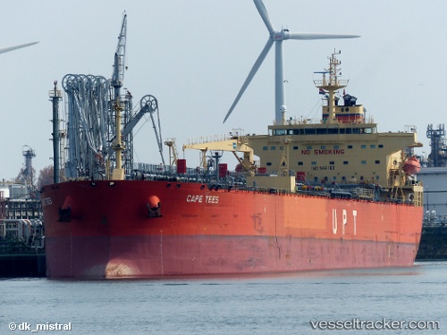
Vessel Cape Tees IMO: 9441180, MMSI: 538003549 Crude Oil Tanker
UTC, 52.18693, 3.61351, course: 70, speed: 0
UTC, 52.18752, 3.61334, course: 78, speed: 0.1
2026-01-16 21:43:06 UTC, 52.19023, 3.61547, course: 174, speed: 0.1
Live AIS position:
UTC. 16 nm NW of Llanwrda),
updated 2026-01-16 21:43:06 UTC.
Find the position of the vessel Cape Tees on the map. The latter are known coordinates and path.
marine traffic ship tracker show on live map
The current position of vessel Cape Tees is 52.19023 lat / 3.61547 lng. Updated: 2026-01-16 21:43:06 UTCDetails:
Last coordinates of the vessel:
UTC, 52.18655, 3.61387, course: 55, speed: 0UTC, 52.18693, 3.61351, course: 70, speed: 0
UTC, 52.18752, 3.61334, course: 78, speed: 0.1
2026-01-16 21:43:06 UTC, 52.19023, 3.61547, course: 174, speed: 0.1