 vesseltracker.com
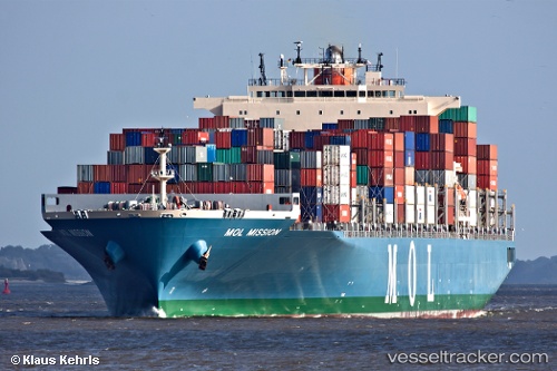
Vessel Mol Mission IMO: 9475650, MMSI: 538004202 Container Ship
UTC, 24.71485, 119.53412, course: 59, speed: 10.6
UTC, 24.97807, 119.84239, course: 40, speed: 10.6
2026-02-01 14:01:04 UTC, 25.21403, 120.10676, course: 44, speed: 10.6
Live AIS position:
UTC. Near Xiaocuo Pt),
updated 2026-02-01 14:01:04 UTC.
Find the position of the vessel Mol Mission on the map. The latter are known coordinates and path.
marine traffic ship tracker show on live map
The current position of vessel Mol Mission is 25.21403 lat / 120.10676 lng. Updated: 2026-02-01 14:01:04 UTCCurrently sailing under the flag of Marshall Is
Mol Mission built in 2011 year
Deadweight:
79491 tDetails:
Last coordinates of the vessel:
UTC, 24.49807, 119.25929, course: 42, speed: 10.7UTC, 24.71485, 119.53412, course: 59, speed: 10.6
UTC, 24.97807, 119.84239, course: 40, speed: 10.6
2026-02-01 14:01:04 UTC, 25.21403, 120.10676, course: 44, speed: 10.6