 vesseltracker.com
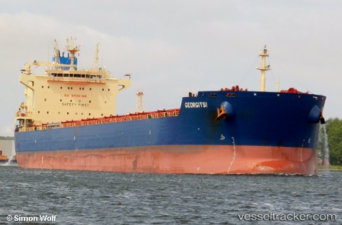
Vessel Georgitsi IMO: 9590113, MMSI: 538004242 Bulk Carrier
UTC, 1.20384, 103.53432, course: 284, speed: 10.8
UTC, 1.42670, 103.15989, course: 305, speed: 10.5
2026-02-02 17:52:47 UTC, 1.57797, 102.95351, course: 308, speed: 11.9
Live AIS position:
UTC. 20 nm SW of Parit Raja),
updated 2026-02-02 17:52:47 UTC.
Find the position of the vessel Georgitsi on the map. The latter are known coordinates and path.
marine traffic ship tracker show on live map
The current position of vessel Georgitsi is 1.57797 lat / 102.95351 lng. Updated: 2026-02-02 17:52:47 UTCCurrently sailing under the flag of Marshall Is
Georgitsi built in 2012 year
Deadweight:
81310 tDetails:
Last coordinates of the vessel:
UTC, 1.17893, 103.81099, course: 243, speed: 12UTC, 1.20384, 103.53432, course: 284, speed: 10.8
UTC, 1.42670, 103.15989, course: 305, speed: 10.5
2026-02-02 17:52:47 UTC, 1.57797, 102.95351, course: 308, speed: 11.9