 vesseltracker.com
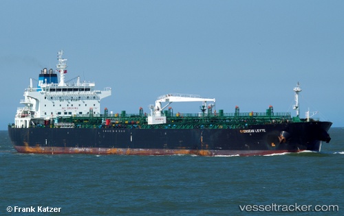
Vessel Seaways Leyte IMO: 9470272, MMSI: 538004255 Crude Oil Tanker
UTC, 10.34137, -75.51575, course: 5, speed: 0
UTC, 10.34130, -75.51575, course: 5, speed: 0
2026-01-14 08:16:23 UTC, 10.34130, -75.51575, course: 5, speed: 0
Live AIS position:
UTC. Near Mamonal),
updated 2026-01-14 08:16:23 UTC.
Find the position of the vessel Seaways Leyte on the map. The latter are known coordinates and path.
marine traffic ship tracker show on live map
The current position of vessel Seaways Leyte is 10.34130 lat / -75.51575 lng. Updated: 2026-01-14 08:16:23 UTCDetails:
Last coordinates of the vessel:
UTC, 10.34135, -75.51577, course: 5, speed: 0UTC, 10.34137, -75.51575, course: 5, speed: 0
UTC, 10.34130, -75.51575, course: 5, speed: 0
2026-01-14 08:16:23 UTC, 10.34130, -75.51575, course: 5, speed: 0