 vesseltracker.com
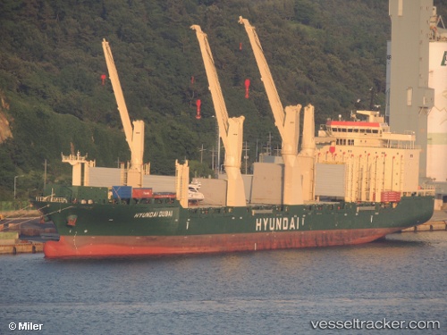
Vessel Hyundai Dubai IMO: 9469900, MMSI: 538004415 Multi Purpose Carrier
UTC, 24.98452, 55.06964, course: 226, speed: 0
UTC, 24.98453, 55.06969, course: 227, speed: 0
2026-01-18 16:15:28 UTC, 24.98453, 55.06963, course: 226, speed: 0
Live AIS position:
UTC. Near Jebel Ali Free Zone),
updated 2026-01-18 16:15:28 UTC.
Find the position of the vessel Hyundai Dubai on the map. The latter are known coordinates and path.
marine traffic ship tracker show on live map
The current position of vessel Hyundai Dubai is 24.98453 lat / 55.06963 lng. Updated: 2026-01-18 16:15:28 UTCCurrently sailing under the flag of Marshall Is
Hyundai Dubai built in 2011 year
Deadweight:
30104 tDetails:
Last coordinates of the vessel:
UTC, 24.98456, 55.06969, course: 226, speed: 0UTC, 24.98452, 55.06964, course: 226, speed: 0
UTC, 24.98453, 55.06969, course: 227, speed: 0
2026-01-18 16:15:28 UTC, 24.98453, 55.06963, course: 226, speed: 0