 vesseltracker.com
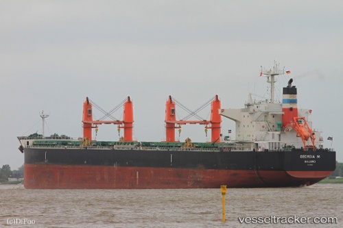
Vessel Georgia M IMO: 9616618, MMSI: 538004498 Bulk Carrier
UTC, 30.02185, 47.95263, course: 173, speed: 0
UTC, 30.02183, 47.95259, course: 173, speed: 0
2026-01-30 06:23:10 UTC, 30.02188, 47.95261, course: 173, speed: 0
Live AIS position:
UTC. Near UMM QASR),
updated 2026-01-30 06:23:10 UTC.
Find the position of the vessel Georgia M on the map. The latter are known coordinates and path.
marine traffic ship tracker show on live map
The current position of vessel Georgia M is 30.02188 lat / 47.95261 lng. Updated: 2026-01-30 06:23:10 UTCCurrently sailing under the flag of Marshall Is
Georgia M built in 2012 year
Deadweight:
58666 tDetails:
Last coordinates of the vessel:
UTC, 30.02188, 47.95260, course: 173, speed: 0UTC, 30.02185, 47.95263, course: 173, speed: 0
UTC, 30.02183, 47.95259, course: 173, speed: 0
2026-01-30 06:23:10 UTC, 30.02188, 47.95261, course: 173, speed: 0