 vesseltracker.com
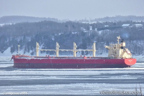
Vessel Federal Tweed IMO: 9658898, MMSI: 538004749 Bulk Carrier
UTC, 49.99592, -66.80570, course: 334, speed: 0.1
UTC, 49.99625, -66.80493, course: 314, speed: 0.2
2026-02-13 13:40:39 UTC, 49.99625, -66.80499, course: 315, speed: 0.1
Live AIS position:
UTC. Near Port-Cartier),
updated 2026-02-13 13:40:39 UTC.
Find the position of the vessel Federal Tweed on the map. The latter are known coordinates and path.
marine traffic ship tracker show on live map
The current position of vessel Federal Tweed is 49.99625 lat / -66.80499 lng. Updated: 2026-02-13 13:40:39 UTCDetails:
Last coordinates of the vessel:
UTC, 49.99603, -66.80526, course: 328, speed: 0.1UTC, 49.99592, -66.80570, course: 334, speed: 0.1
UTC, 49.99625, -66.80493, course: 314, speed: 0.2
2026-02-13 13:40:39 UTC, 49.99625, -66.80499, course: 315, speed: 0.1