 vesseltracker.com
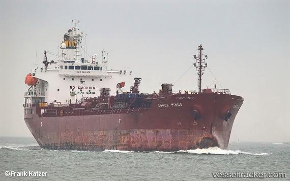
Find the position of the vessel SONGA WINDS on the map. The latter are known coordinates and path.
marine traffic ship tracker show on live map
The current position of vessel SONGA WINDS is -2.79473 lat / 122.205 lng. Updated: 2025-05-13 05:36:20 UTCCurrently sailing under the flag of Marshall Islands
SONGA WINDS built in 2009 year
Speed:
14.8 knotDeadweight:
19954 tPayload_mass:
19954 tonneGross tonnage:
11773Service entry:
2009-01-01T00:00:00ZDetails:
Last coordinates of the vessel:
UTC, -2.7941, 122.206, course: 152, speed: 0.1UTC, -2.79487, 122.206, course: 98, speed: 0
UTC, -2.79533, 122.205, course: 75, speed: 0
2025-05-13 05:36:20 UTC, -2.79473, 122.205, course: 103, speed: 0