 vesseltracker.com
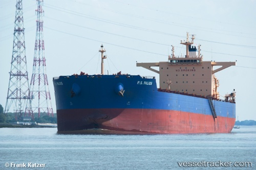
Vessel P.s.palios IMO: 9573103, MMSI: 538004949 Bulk Carrier
UTC, 32.10827, -14.09965, course: 18, speed: 11.4
UTC, 32.28856, -14.04081, course: 16, speed: 11.4
2026-02-18 19:22:25 UTC, 32.66935, -13.92520, course: 14, speed: 11.3
Live AIS position:
UTC. 124 nm E of Porto Santo Island),
updated 2026-02-18 19:22:25 UTC.
Find the position of the vessel P.s.palios on the map. The latter are known coordinates and path.
marine traffic ship tracker show on live map
The current position of vessel P.s.palios is 32.66935 lat / -13.92520 lng. Updated: 2026-02-18 19:22:25 UTCDetails:
Last coordinates of the vessel:
UTC, 31.57399, -14.25147, course: 14, speed: 11.7UTC, 32.10827, -14.09965, course: 18, speed: 11.4
UTC, 32.28856, -14.04081, course: 16, speed: 11.4
2026-02-18 19:22:25 UTC, 32.66935, -13.92520, course: 14, speed: 11.3