 vesseltracker.com
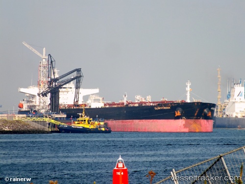
Find the position of the vessel Glorycrown on the map. The latter are known coordinates and path.
marine traffic ship tracker show on live map
The current position of vessel Glorycrown is 1.19344 lat / 103.745 lng. Updated: 2025-05-13 10:24:55 UTCPayload_mass:
156654 tonneGross tonnage:
83805Service entry:
2009-01-01T00:00:00ZManufacturer:
Details:
Last coordinates of the vessel:
UTC, 1.19344, 103.745, course: 138, speed: 0UTC, 1.19344, 103.745, course: 138, speed: 0
UTC, 1.19344, 103.745, course: 138, speed: 0
UTC, 1.19344, 103.745, course: 138, speed: 0
UTC, 1.19344, 103.745, course: 138, speed: 0
2025-05-13 10:24:55 UTC, 1.19344, 103.745, course: 138, speed: 0