 vesseltracker.com
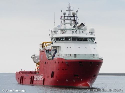
Vessel Go Electra IMO: 9545481, MMSI: 538005197 Well Stimulation Vessel
UTC, 56.20775, 7.19235, course: -1, speed: 8.8
UTC, 56.97055, 8.02062, course: 26, speed: 8.7
2026-03-02 03:53:58 UTC, 57.15914, 8.24641, course: 37, speed: 8.5
Live AIS position:
UTC. 11 nm W of HANSTHOLM),
updated 2026-03-02 03:53:58 UTC.
Find the position of the vessel Go Electra on the map. The latter are known coordinates and path.
marine traffic ship tracker show on live map
The current position of vessel Go Electra is 57.15914 lat / 8.24641 lng. Updated: 2026-03-02 03:53:58 UTCCurrently sailing under the flag of Marshall Is
Go Electra built in 2012 year
Deadweight:
3123 tDetails:
Last coordinates of the vessel:
UTC, 56.20775, 7.19235, course: -1, speed: 8.8UTC, 56.20775, 7.19235, course: -1, speed: 8.8
UTC, 56.97055, 8.02062, course: 26, speed: 8.7
2026-03-02 03:53:58 UTC, 57.15914, 8.24641, course: 37, speed: 8.5